As someone who has flown mountain routes extensively and made some poor weather decisions early in my flying career that I’d rather not repeat, I learned everything there is to know about mountain weather and how it behaves differently from what you see in the flatlands. Today, I will share it all with you — because this is genuinely the subject where understanding the physics can save your life.
What follows covers the essential weather knowledge every mountain pilot needs: how terrain affects weather development, the specific hazards unique to mountain flying, and practical techniques for gathering and interpreting weather information before and during flight.
How Mountains Create Their Own Weather
Orographic Lifting – The Basics
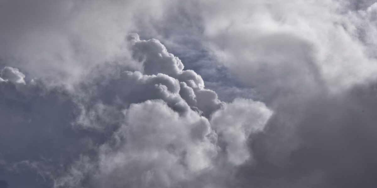
When air masses hit mountain barriers, they’re forced upward. This orographic lifting cools the air, potentially reaching saturation and producing clouds and precipitation on the windward side of ranges.
The Sierra Nevada provides the classic example. Pacific moisture hits the western slopes, dumping significant precipitation. By the time air descends the eastern slopes, it’s much drier, creating the rain shadow that gives Nevada its desert climate. I flew into Truckee once and the conditions were markedly different than what I’d seen in Sacramento an hour earlier — that’s this phenomenon in real time.
Probably should have led with this, honestly: cloud bases and visibility can differ dramatically on opposite sides of a mountain range. A forecast for clear conditions in one valley may not apply to the next valley over. I’ve seen VFR conditions on the western side of a ridge and IMC within five miles on the eastern side.
Thermal Activity Patterns
Differential heating creates predictable patterns. Sun-facing slopes warm faster than shaded areas, generating thermals and associated turbulence.
Morning flights often encounter smooth air because surfaces haven’t heated sufficiently to generate significant convection. By early afternoon, thermals can produce moderate to severe turbulence, particularly along ridge lines and in canyons. I’m apparently someone who learned this rule and still occasionally pushes the afternoon timing — I do not recommend it.
That’s what makes early morning departures standard practice among experienced mountain pilots — you maximize aircraft performance while minimizing turbulence exposure. The pilots who’ve been flying these routes for thirty years leave early. There’s a reason.
Wind Effects on Terrain
Terrain channels and accelerates wind in predictable ways. Passes and saddles create natural funnels where wind speeds can double or triple compared to surrounding areas. Canyon walls produce rotors and mechanical turbulence that can exceed aircraft structural limits.
Mountain waves form when stable air flows over ridges. These waves can extend to great heights and produce severe turbulence, particularly in the rotor zones below the crests. Lenticular clouds marking wave activity should prompt serious consideration of alternate routes — those smooth-looking lens-shaped clouds are not your friends.
Critical Weather Hazards
Downdrafts and Sinkers
Descending air on the lee side of ridges can exceed aircraft climb capability. A fully-loaded airplane at high density altitude may struggle to maintain level flight in strong sink. Pilots have been forced into terrain simply because their aircraft couldn’t outclimb the descending air mass — and the terrain doesn’t move out of the way.
The hazard increases with wind speed and terrain steepness. Crossing ridges at minimum altitude in strong winds is extremely dangerous regardless of aircraft capability. Standard practice involves crossing ridges at least 2,000 feet above the crest when winds exceed 25 knots at ridge level. That margin feels excessive until the day you actually need it.
Mountain Obscuration
Clouds forming around peaks and in valleys can trap pilots in instrument conditions with terrain on all sides. Unlike flat country where a pilot can descend to regain visual conditions, mountain terrain offers no such option.
Low ceilings and reduced visibility account for a substantial percentage of mountain flying accidents. The rule is simple: if you can’t maintain visual contact with terrain, don’t fly into it. No destination is worth what happens when that rule gets bent.
Density Altitude Effects
High elevation airports combined with warm temperatures create density altitudes that dramatically reduce aircraft performance. An airplane that easily climbs at sea level may barely maintain altitude at a 9,000-foot strip on a hot afternoon.
Many mountain flying accidents occur during takeoff when aircraft fail to accelerate as expected or climb sufficiently to clear terrain. Allowing extra runway margin and accepting reduced loads provide insurance against performance shortfalls. The performance charts in the POH assume standard conditions — mountain summer afternoons are rarely standard anything.
Thunderstorm Development
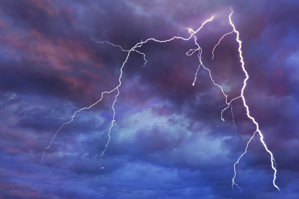
Mountain terrain accelerates thunderstorm development by providing lifting necessary to trigger convection. Storms can build faster and produce more severe conditions than forecasts predict.
Typical patterns involve morning sunshine followed by cumulus development during midday and thunderstorms by mid-afternoon. Pilots caught in mountain thunderstorms face turbulence, hail, and lightning with nowhere to land and limited maneuvering room. The only safe strategy is avoiding storms entirely by completing flights before convection develops. If you’re still airborne at 2pm in the Rockies in July, you’ve already made the first mistake.
Weather Information Sources
Standard Aviation Weather
METARs, TAFs, AIRMETs, and SIGMETs provide baseline information. However, these products often don’t adequately represent conditions in mountainous terrain. Reporting stations are typically located in valleys near airports. They may show calm winds and clear skies while ridges just miles away experience strong winds and clouds. Use them as a starting point, not a final answer.
PIREPs: The Most Useful Real-Time Information
Pilot reports provide the most useful real-time information about mountain conditions. Turbulence, icing, and cloud tops reported by other pilots flying the same terrain offer insight unavailable from any other source. File PIREPs yourself — it pays back into the system every pilot depends on.
Camera Networks
FAA and state aviation agencies operate camera networks showing real-time conditions at mountain passes and remote airports. These images reveal current visibility, cloud bases, and precipitation better than any textual report. Before any mountain flight, I check the relevant cameras. It takes five minutes and has talked me out of flights that looked fine on paper.
Local Knowledge
Experienced local pilots understand patterns that don’t appear in formal products. They know which canyons develop fog first, where afternoon turbulence is worst, and how long typical weather patterns last. Building relationships with pilots who fly your intended area regularly provides invaluable insight that no app or briefing service can replicate.
Practical Decision Making
Establishing personal minimums specific to mountain flying provides decision framework before launch. Consider factors including ceiling heights above terrain, visibility, wind speeds at ridge level, temperature and density altitude effects, and convective potential. If any factor exceeds personal limits, postpone the flight — and write down those limits before you’re in the planning phase so emotion doesn’t edit them.
Every mountain flight should include identified escape routes should conditions deteriorate. Knowing where to turn, where VFR conditions exist, and where emergency landing options lie helps make prompt decisions when needed. Predetermined abort criteria eliminate the temptation to press on when conditions worsen. Human tendency is to continue, hoping conditions improve. Predetermined criteria substitute rational planning for emotional decision-making during stress — and mountain flying produces stress reliably.


Leave a Reply